The Longitude of Self-Reliance
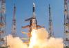
India has taken another important step towards technological self-reliance with the successful launch of NVS-03, its next-generation navigation satellite, aboard the GSLV-F18 launch vehicle. This marks a significant advance in strengthening Navigation with Indian Constellation (NavIC), the country’s independent satellite navigation system.
The mission underscores how satellite navigation has evolved from a specialised technological capability into critical national infrastructure. Transportation, maritime operations, disaster management, telecommunications and strategic applications increasingly depend on accurate positioning, navigation and timing services.
The Geosynchronous Satellite Launch Vehicle (GSLV), developed by the Indian Space Research Organisation (ISRO), is one of India's principal launch vehicles for deploying heavier satellites. Its capabilities have been instrumental in expanding the country's presence in communication, meteorology and navigation.
GSLV-F18 marked the vehicle's 20th flight and carried NVS-03 into a geosynchronous transfer orbit (GTO). This elliptical intermediate orbit enables a satellite to manoeuvre towards its intended operational orbit using its onboard propulsion system.
Launching a satellite is only the beginning of a complex process. Orbital manoeuvres, commissioning and validation of onboard systems must follow before the spacecraft can deliver operational services. The success of a mission therefore depends as much on what happens after liftoff as on the launch itself.
Cutting-Edge Technology
NVS-03 is the third satellite in India's second-generation navigation satellite series, designed to sustain and enhance the Indian Regional Navigation Satellite System (IRNSS), now known as NavIC.
Among its important technological features is an indigenous atomic clock, alongside procured atomic clocks. The satellite will also introduce the L1 navigation frequency in addition to the existing L5 and S-band signals. Its planned coverage encompasses the Indian landmass and a region extending approximately 1,500 kilometres beyond the country's geographical boundaries.
Precision timing is fundamental to satellite navigation. Satellites transmit radio signals containing information about their positions and the precise time of transmission. Receivers on Earth calculate their distance from satellites by measuring the time taken for these signals to arrive. Since radio signals travel at approximately 300,000 kilometres per second, even a minuscule timing error can produce a substantial positioning discrepancy. An error of just one-millionth of a second translates into approximately 300 metres.
The incorporation of indigenous atomic clock technology reflects India’s growing ability to develop specialised components for demanding space applications. However, navigation accuracy also depends on orbital precision, signal quality, ground-control infrastructure and sophisticated error-correction systems.
The introduction of the L1 frequency is another important development. Widely used by established civilian satellite navigation systems, L1 is supported by numerous navigation receivers. Its inclusion in the newer NavIC satellites is intended to broaden the system's accessibility and compatibility with appropriately equipped devices.
This could expand civilian applications ranging from road navigation and fleet management to location-based services. Multiple frequencies can also help receivers compensate for certain signal errors, including those arising from atmospheric interference.
However, the additional frequency does not automatically make every existing smartphone or navigation device compatible with NavIC. Such compatibility depends on the receiver’s hardware, firmware and software support for the relevant signals.
Like the American Global Positioning System (GPS), NavIC provides positioning, navigation and timing information. Unlike global systems designed for worldwide coverage, it is primarily intended to serve India and its surrounding region.
For India, an independent navigation capability has considerable strategic significance. Dependence on external satellite navigation infrastructure can create vulnerabilities in situations involving geopolitical tensions or security emergencies. An indigenous constellation gives the country greater control over a critical technological resource, even as it complements other global navigation systems.
The need to maintain such infrastructure is particularly pressing because navigation satellites have finite operational lifetimes and require periodic replacement. In January 2025, NVS-02 reached its initial orbit after launch but could not complete the manoeuvres necessary to enter its intended operational orbit because of a propulsion-system problem. The episode illustrated the complexity of satellite operations and the importance of post-launch reliability.
NVS-03 must consequently be viewed as part of a continuing effort to strengthen the constellation rather than as an isolated achievement.
By investing in indigenous precision timing, navigation signals and space infrastructure, India is building the technological foundations of strategic autonomy. In an increasingly interconnected world, the ability to determine one’s position and synchronise critical systems is an instrument of national capability.
(The writer is Chief Executive, National Centre for Science Communicators, Mumbai. Views personal.)